Starts @
₹15,500.00
Explore the world with us, one adventure at a time.
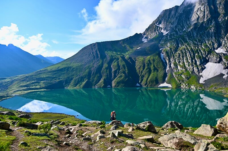
Kashmir Great Lakes Trek
(52 Reviews)
4.5/5
Share On
Package Details
Per Person
₹15,500.00
Sonmarg to Srinagar
Duration
8 Days
Location
sonmarg
Group Size
20
Age Range
18+
Overview
In the western Himalayas of the Kashmir area, there is a moderate hiking path called the Kashmir Great Lakes Trek. The Sonamarg base camp is situated on the National Highway between Srinagar and Leh. You may also reach the final destination, Naranag village, using this highway. Though it may be done either way, the journey is best done in a westerly direction, starting in Sonamarg and ending at Naranag, to avoid the direct sun. A series of alpine lakes dotting the slopes of several snow-capped mountain peaks make up the Great Lakes, as the name implies. The lakes of Vishansar and Gangabal are the most well-known. It averages an elevation of 4000 metres above sea level, traverses three mountain passes, and goes through many verdant alpine meadows. At 5300 metres above sea level, Mount Haramukh is the highest mountain peak of the walk and the dominant feature of the second section of the trek.
Complete Itinerary
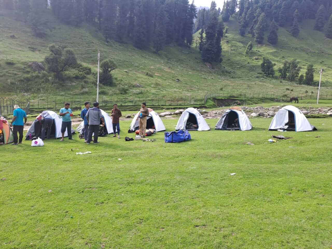
Shitkadi Village, located just ahead of Sonamarg and around three hours' drive from Srinagar, is the starting point for the trek to Kashmir Great Lakes. We will take you from Sonamarg and drop you off at Shiitkadi, where you may spend the night before setting off on your trekking experience the following day. Enjoy a day in Shitkadi Village and its picturesque environs before setting off on your trekking expedition. Kolahoi, Machoi, Amarnath Peak, Machoi Glacier, and Tribal are among the magnificent mountain peaks that can be seen. On your way to the campground, you'll pass through some breathtaking scenery, including expansive meadows and grasslands. Shitkudi Campsite is where you'll be staying. On the evening before to supper, there will be a meeting for briefing. Eat breakfast early and get enough of sleep so you can start your walk tomorrow refreshed.
6 hours and 9 km of gradual climbing to Nichinai follows a 3-hour climb, a 1-hour descent, and a last mild ascent. The journey begins on Srinagar Road, three km outside of Sonamarg. When you reach 3 km, look for a single Dhaba on your right. In case you forgot to bring any snacks or little meals with you, here is the final stop for bottled water, cookies, etc. After the trek, you may find the next sign of civilization in Naranang. In front of the store, a jeep track branches off the main road and takes a right turn. As it winds its way between the mud track and the main road, the route descends to the level of the Sindh River. Initially following the track, the walking route soon changes direction and goes higher. After a ten-minute ascent, the path takes a sharp turn and leads into a verdant meadow. Sonamarg town is plainly visible from the meadow. Half an hour later, you'll be at the meadow's highest point, when the Maple and Pine tree lines begin. The route drops down to a little creek after you hit the tree line, then rises back up; what comes next is a beautiful, thick grove of maple trees. One must-do in Kashmir, India, is to walk on verdant grass under a canopy of maple trees. Within half an hour, you will reach the terminus of the birch trees; from there, the route descends before ascending again into a river valley. At its base, Nichinai is the River Valley. The path continues upstream, following the right side of the river. The Sonmarg Valley's snow-capped peaks may be seen from behind. A broad valley now lies before you, encircled on all sides by towering mountains. At last, the valley is crossed by the swiftly flowing river that empties into the Sindh. If you're using mules, be patient since the first half of the trail is over rocks. A further hour down the river valley reveals verdant, rock-free areas. In the space between the two mountain ranges, the river valley opens up and a verdant meadow spreads forth. Triangular twin snow-capped summits lay far ahead. After you've found a level area to set up your tents at Nichinai campground, the first day of hiking is over.
The Vishansar Lake, which is the first of the Great Lakes, is the destination of our journey, which we begin early in the morning, perhaps between seven and eight o'clock. It is more or less a lengthy walk across the alpine meadows of Kashmir that constitutes the trip for the day. You should begin your journey from Nichinai to Nichinai Pass, which may be seen from the campground throughout your trek. After a half an hour of walking, you will have to across the gurgling stream in order to reach the left bank of the stream. Right here is where the route begins its ascent, and for the next hour, you will be climbing steadily upward until you reach the Nichinai Pass.
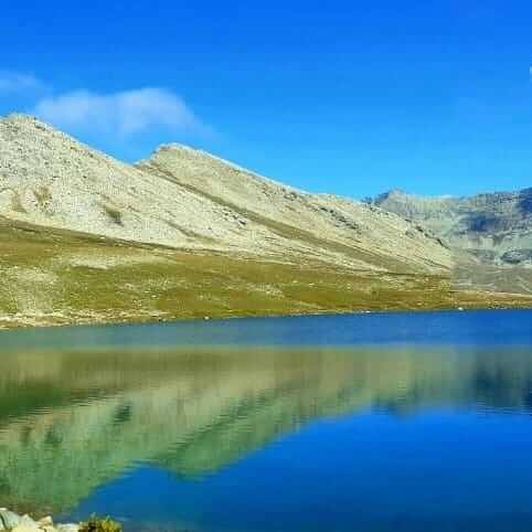
At an elevation of 13,500 feet, the Nichinai Pass is the highest point that may be reached on the walk that we are going to take today. After descending a short distance from the pass, the path leads to Vishansar Lake, which is reached by walking on a level path across the meadow. As you continue to ascend the Pass, you will eventually be able to view the lake that is located at the base of the mountains; it has the appearance of a little enclosure that has a deep blue colour. It is important to note that the path you are now traversing is not the original ridge, and it will make two turns inwards before you reach the Nichinai Pass. From the summit of the Nichinai Pass, which is similar to a large tunnel, one can see the Sonamarg Valley that is located below. This is the last location where you will be able to connect to any network, and the BSNL network here is very unreliable. You will be able to access the further traces of the network after you have passed beyond Gangabal boundaries.
The Himalayan area is characterised by its towering peaks, which are located on the left side of the route. On the right side of the pass, there are no mountains but the terrain is somewhat elevated. It is possible that some people may find the ascent to the Nichnai Pass to be a little bit challenging since it is a straight ascent; nevertheless, there is some good news about the trip that follows the pass because it is a descent. Over the course of about one hour, you will arrive at green fields from the rocky region. The road that leads down from the pass lowers significantly. The meadow is a large stretch of land that extends far and wide, including snow-covered mountains that encircle the whole field. Beyond the pass, there is another river that flows into the meadow that is in front of you. You will also see a large waterfall that is pouring down and blending in with the river to your left when you are there. While you are walking through the meadows, you will see that there are two streams that cross the meadows. You should stay on the banks of the stream that is on the left.
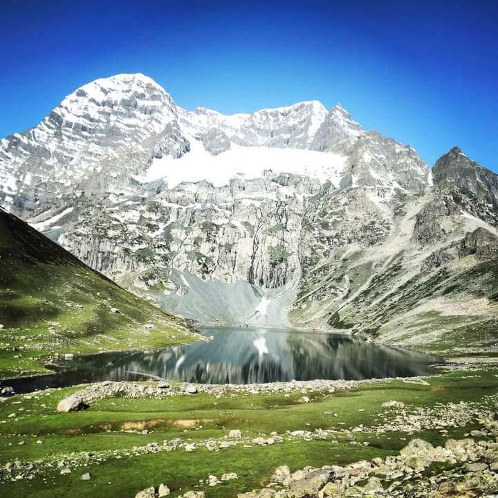
After about half an hour, you will have to cross the stream, but you should be prepared since the water is going to be very high in temperature. This river travels in a direction that is perpendicular to the direction of the valley's end, from left to right, and it is really the Vishansar Lake that is the source of this river. Due to the fact that it is located a bit higher on the top, the lake is not yet visible. It is an excellent idea to set up your tents here, since it is close to the river. In the event that you have sufficient time after the trek, you may go on an excursion to the twin lakes, or you can wait until the sixth day to do so. From your campground, Vishansar Lake may be around half a km distant and approximately one hundred feet high. There is a wonderful reflection of the Kishansar Lake in the waters of the Vshnusar Lake, which is tucked in a stunningly picturesque location between four mountains. Depending on the time of day and the amount of cloud cover, the hue of the lake shifts between different shades. Before dawn, the lake is often colourless, and on a day when the sky is clear, the water of the lake begins to become blue as the sun rises.
On a day when the sun is shining, the water of the lake is a rich aquamarine blue. When the sun is getting closer to setting, the sky becomes a greenish-blue colour. This happens towards the end of the day, when the sun is getting closer to setting. As you continue on your journey, you will ultimately come across a number of lakes, and this is the first lake you will encounter along the way. We will set our camp today in the vicinity of Vishansar Lake.
The fourth day is set aside for acclimatisation since it is necessary to provide your body with sufficient time to acclimatise to the circumstances that are present at a greater altitude. The Kishansar Lake is the lake that comes after the Vishansar Lake in the sequence of lakes. The distance between Kishansar and Vishansar is half a km, and Kishansar is located at the foot of Kishansar Tower. It is estimated that the journey from Vishansar to Kishansar will take around forty-five minutes. Acclimatisation may be accomplished by going on a short stroll to Krishansar Lake, which might be considered a short walk. From the right side of Vishansar Lake, the path that leads to Kishansar Lake begins its ascent. An expansive meadow can be found on the right-hand side of Kishansar Lake, and it is an ideal location for taking photography.
Gadsar Pass will be the route that we take today to reach Kishansar Lake. You should be able to see a very thin line travelling through the side of the mountain from where you are camping; this is the path that you need to take today. After climbing for almost an hour and a half, you will reach the peak of a ridge. After another forty-five minutes of climbing, you will reach a location that will completely fascinate you with its breathtaking panorama. You will eventually reach a location where you will be able to see the Kishansar Lake and the Vishansar Lake coming together in full view.
Even as you make your way to the summit of Gadsar Pass, you will be accompanied by this breathtaking panorama. On today's trek, the Gadsar Pass, which is located at an elevation of 13,750 feet, is the highest point that may be reached. For a time, take in the breathtaking panorama that can be seen from the peak of Gadsar Pass before continuing on. The Himalayas, which are covered in snow, can be seen on one side of the horizon line, and on the other side, there is a breathtaking valley that spreads out and has two or three little lakes that can be seen from the top. When seen from the highest point of Gadsar Pass, the peaks that are visible are located outside of the Line of Control (LOC). Even though there aren't many people that camp in this region, we will be setting up tent in the Gadsar Lake area for the day. Be careful to leave the campground in the same state of cleanliness that you found it in if you are camping in the vicinity of Gadsar. If you do not want to camp along the lake, you will need to continue your ascent downwards until you reach the Gadsar army camp.
An further blue lake can be seen on the left-hand side of the valley, which is visible around half an hour into the trek. The valley, which was before narrow, opens up and becomes larger. There is a significant amount of height that you are losing as you continue to go forward. As you continue travelling for another half an hour, you will begin to see the Shepherd huts that are line the side of the valley. If you continue continuing, you will eventually arrive at the army camp after around half an hour on foot. In order to proceed farther outside the confines of the army camp, you will be required to secure authorization from the army headquarters. The army camp is a modest structure that accommodates between five and eight soldiers. Following the tree line into the settlement will lead you to the headquarters, which is placed three miles away from the checkpoint for your convenience. The headquarters of the Gadsar army camp is equipped with a satellite phone, while the army camp itself uses walkie talkies for communication.
A helpful hint: When you are in close proximity to the army camp, you should report as soon as possible since it takes around two to three hours for the green signal to be sent from the headquarters. Before you are allowed to move forward, the evidence of your identification will be examined, gathered, and documented.
Gadsar Pass will be the route that we take today to reach Kishansar Lake. You should be able to see a very thin line travelling through the side of the mountain from where you are camping; this is the path that you need to take today. After climbing for almost an hour and a half, you will reach the peak of a ridge. After another forty-five minutes of climbing, you will reach a location that will completely fascinate you with its breathtaking panorama. You will eventually reach a location where you will be able to see the Kishansar Lake and the Vishansar Lake coming together in full view. Even as you make your way to the summit of Gadsar Pass, you will be accompanied by this breathtaking panorama. On today's trek, the Gadsar Pass, which is located at an elevation of 13,750 feet, is the highest point that may be reached.
For a time, take in the breathtaking panorama that can be seen from the peak of Gadsar Pass before continuing on. The Himalayas, which are covered in snow, can be seen on one side of the horizon line, and on the other side, there is a breathtaking valley that spreads out and has two or three little lakes that can be seen from the top. When seen from the highest point of Gadsar Pass, the peaks that are visible are located outside of the Line of Control (LOC). Even though there aren't many people that camp in this region, we will be setting up tent in the Gadsar Lake area for the day. Be careful to leave the campground in the same state of cleanliness that you found it in if you are camping in the vicinity of Gadsar. If you do not want to camp along the lake, you will need to continue your ascent downwards until you reach the Gadsar army camp. An further blue lake can be seen on the left-hand side of the valley, which is visible around half an hour into the trek. The valley, which was before narrow, opens up and becomes larger. There is a significant amount of height that you are losing as you continue to go forward. As you continue travelling for another half an hour, you will begin to see the Shepherd huts that are line the side of the valley. If you continue continuing, you will eventually arrive at the army camp after around half an hour on foot.
In order to proceed farther outside the confines of the army camp, you will be required to secure authorization from the army headquarters. The army camp is a modest structure that accommodates between five and eight soldiers. Following the tree line into the settlement will lead you to the headquarters, which is placed three miles away from the checkpoint for your convenience. The headquarters of the Gadsar army camp is equipped with a satellite phone, while the army camp itself uses walkie talkies for communication. A helpful hint: When you are in close proximity to the army camp, you should report as soon as possible since it takes around two to three hours for the green signal to be sent from the headquarters.
Before you are allowed to move forward, the evidence of your identification will be examined, gathered, and documented.
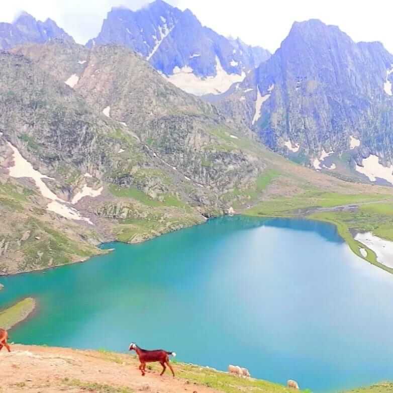
From the army camp, make your way to the left in the direction of the stream in order to ascend the mountain. Currently, you are situated above the tree line, and you are able to see the tree cover and the rivers that are nearby. The ascent continues for an hour and a half, during which time you increase your elevation by 1,100 feet. Following the crossing of the 11,500-foot mark, the ascent changes into a traverse and then turns to the left, leaving the river valley behind. As soon as you emerge from the river valley, you will find yourself wandering over a level meadow that is encircled by mountains on all sides. You may also see a few craters to your right as you make your way along this portion of the route, which is known as Maegandob. It won't be long until you see the first of the Satsar Lakes. It is possible to interpret the word Satsar as "Sat," which means seven, and "Sar," which means lake.
Satsar is a group of seven lakes, which is justified by the importance of the name of the collection. Our campsite for the day is located near Satsar Lake. In the vicinity of the lake, choose a site that is perfect for camping and set up your tents. After a hard day of trekking, you should retire early in your tents and allow your body the rest it needs to recover thoroughly.
All throughout the path, there is a consistent pattern of ascending and descending. After hiking for a half an hour, you will arrive at the Satsar Lake that is the largest of the Satsar Lakes and also the final one in the series.
Our trek will begin at our campground, and from there, we will begin our journey. This is a mostly stony landscape that is replete with boulders. The route continues to descend from the lake and continues for around half an hour on this track. At the end of this trail, you will reach the first forest line. One of the ridges is located on your right, while the forest line is located on your left. In order to reach the top of the first ridge, you will need to climb two additional ridges, and the landscape from the base to the top of the ridge is rocky and barren. From this point on, you will once again gain height by following a track that is zigzag-like.
You will see that there are few Gujjar cottages and some vegetation on the other side of the route, which stands in sharp contrast to the desolate nature of the path you are now on. When you are climbing, there are no water sources available; however, when you are descending, you will come across a creek, and after crossing the wooden bridge, you will arrive to Nandkol, which is where you will be sleeping for the night. Green Trails considers the Nandkol campground to be a Green Trails Hotspot since it is a popular camping place. Remains of camping may be seen in many locations throughout the area. For a weekend excursion, a large number of people go from Naranang to Gangbal, which results in a significant amount of rubbish being produced at both locations. In addition, Nandkol and Gangbal are particularly well-known sites for fishing, particularly for trout.
Nandkol is located twenty minutes away from Gangbal Lake, and a stream links the two locations. The Gangbal Lake is next to Nandkol. In order for us to go from one lake to the other, we will have to cross the creek. On the lower level, you should avoid crossing the creek; instead, you should go all the way to Gangbal, where you will discover a bridge that has been constructed. It will take at least an hour to complete a full round of Gangbal Lake since it is a large lake.
Despite the fact that today is an entirely downhill climb, you should be prepared to feel the strain on your knees from the steep fall. Climb down from the ridge following the stream towards the tree covers from your Gangabal campsite.
Once you're 30 minutes into your trek and the airtel network starts to catch up, you may let your home know that you've arrived safely! You will reach a level meadow as the ridge comes to a close. Standing towering and majestic, Harmukh Peak may be seen in the distance as you glance back from this vantage point. At the one-hour mark of the trek, you'll start to reach the treeline, which is largely composed of pine trees. A log cabin will also start to pop into view, which is a sign of civilization. For the next six km, you'll be weaving in and out of the woodland without gaining any ground. Halfway through the hike, you'll see the route start to fall, and it's a steep one.
Through dense pine forests, you'll find a muddy, well-traveled path. In the last four km of the trek, you'll descend more over three thousand feet in elevation. As you descend, you could even see a large number of hikers; they are making the journey from Naranang to Gangabal. With only a little distance remaining, Naranang is gradually approaching. The final section might put your stamina to the test due to its steepness. Just a little distance ahead, you'll see a stone-paved route leading into the settlement of Naranang.Your journey to Srinagar will begin here.
Predict that you will arrive in Srinagar about 6:30 p.m. Your future travel arrangements may be made from this point forward.
Inclusion & Exclusion
Transportation between Sonmarg to Srinagar, beginning with pick-up on Day 1 and ending with drop on last day.
Every meal is vegetarian (sometimes eggs will also be served), beginning with breakfast on day one and continuing through lunch on last day.
Staff consisting of a professional guide, a chef, and support team.
Equipment for camping, such as stools, toilet seats, and other seats, sleeping bags, crampons
Fees required to enter the forest.
Tented accommodation throughout the trek, with guests sharing tents in twin-person ratios.
Medical kits
All necessary permits
Insurance
Support from a porter and a mule to carry one’s personal belongings. Porter/mule costs for personal baggage* per bag per person INR 300 per day.
Transportation from your hometown and back
Personal costs like tips, foods from stalls, phone calls, etc.
Any costs that are incurred as a result of unanticipated occurrences such as adverse weather, obstacles, medical evacuation, etc.
Things to Carry
Government issues Id Card
Backpack
Headlamp
Sunglasses
Rain gears
Bag rain cover
Woolen and Sun cap
Buff
Thermals
T-shirts
Personal first aid kit and medicines
Waterproof Trekking shoes (can be available for rent also*)
Fleece and Down Jacket
Waterproof gloves
Trek pants
Warm socks
Water bottle
Sunscreen and body lotion
Lip balm
Person Toiletries
Sanitizer
Power Bank
Glucose
Chocolates
Tissue paper and Wet Wipes
FAQ's
The best time to visit or book KGL package is in:
- July, August, and September.
Kashmir Great Lakes trek is suitable for both beginners and experienced trekkers. Any age group from 10 to 17 is good to apply for a first-time trekking experience. Adults and seniors should carry doctors' notes for their fitness requirements for the journey. They should be fit enough to cover a 4 km distance in 30 minutes and should be able to carry at least a 10 kg backpack
Temperature is generally between 3-6 degree Celsius in day time and 3 to -10 degree Celsius in night time.
Why Choose Us
➫ Safety
The group of highly skilled and experienced guides at Universal Camper is here to ensure that your trek is as risk-free and trouble-free as is humanly feasible. Every single one of our guides has a medical degree and a wealth of experience putting their education to use in mountainous situations.
➫ Expert Team
The members of our team and guides are the foremost experts in their particular ecosystems. Every guide offers a one-of-a-kind blend of years of expertise in both trekking field and providing services to guests.
➫ Comfort Stay
We make sure that your time on the journey is as pleasant as possible. Tents and sleeping bags are supplied, and guests may choose to share with a partner or three others. Camping gear, including tents and sleeping bags, is always spotless.
➫ Customized Trekking
Today, time is of the essence, and we recognise that you may not be able to modify your schedule to match ours. No need to worry about it; we can create a custom trip for you in which you choose the dates, the route, and the other participants.
➫ Cooked and Hygienic Food
During the journey, the staff from Universal Camper will ensure your safety and provide you with healthy and cooked meals. When it comes to tasty cuisine, they will not settle for second best. Every time you order, you can be certain that you’ll be served with clean, well washed cutlery.
➫ Value for Money
Not only do we provide competitive pricing to our clients but we also take into account the greatest possible variety of options and adaptability in our deliberations. In addition, Our Company offers a safe payment system that alleviates the anxiety and inconvenience associated with travelling by giving simple payment alternatives. These possibilities include credit as well as bank-to-bank transfers and upi payments.
Package Details
Per Person
₹15,500.00
Srinagar to Srinagar
Explore Our
Related Trek
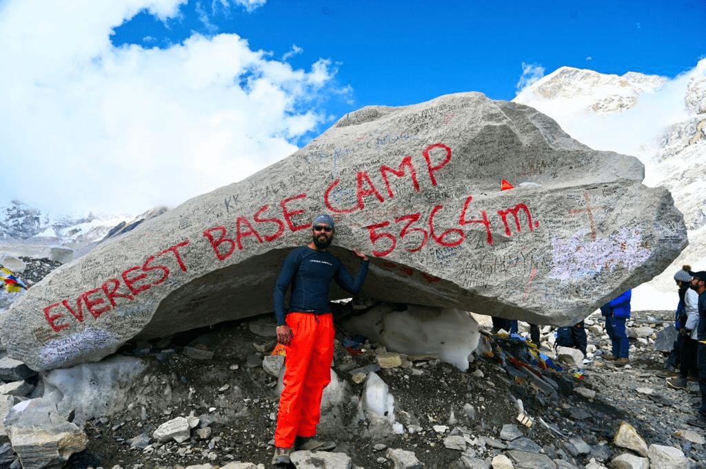
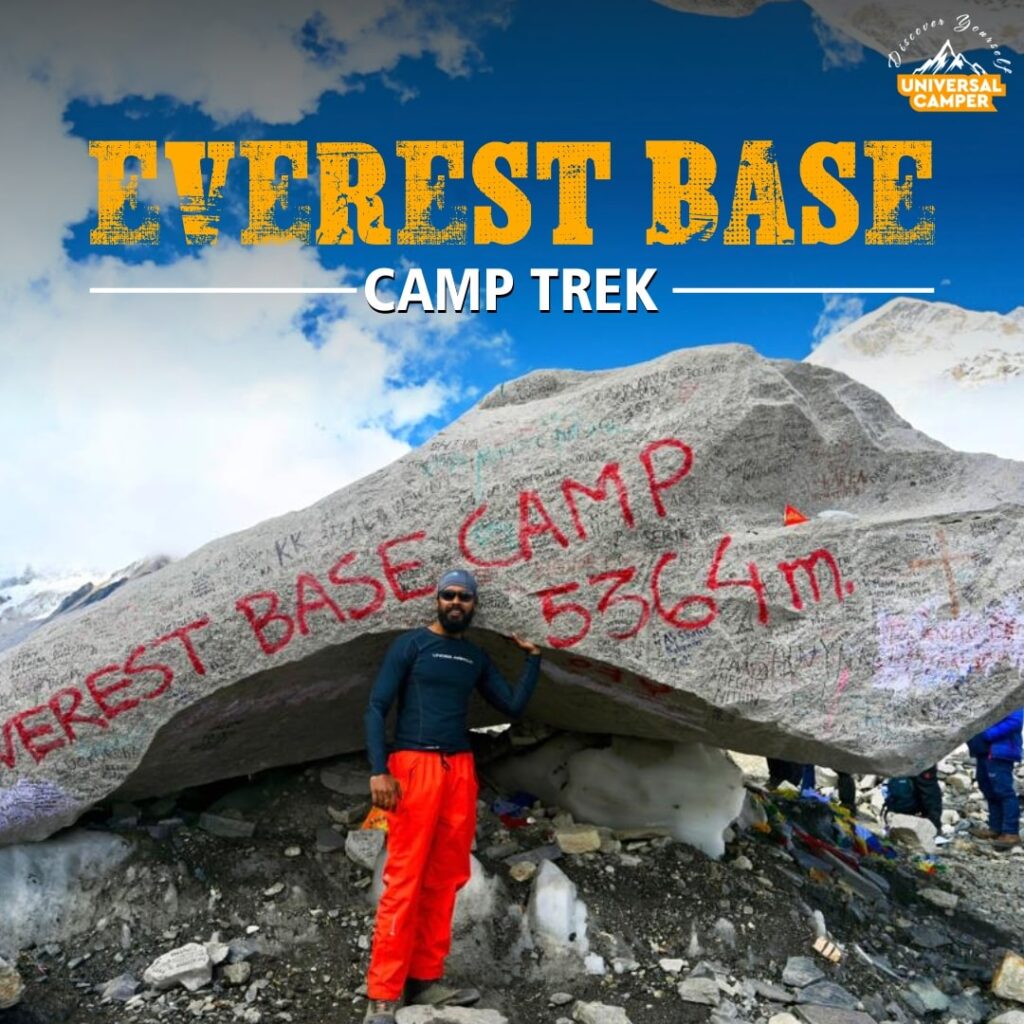
Everest Base Camp Trek
- 14 Days
- Nepal

Hampta Pass Trek
- 5 Days
- Manali
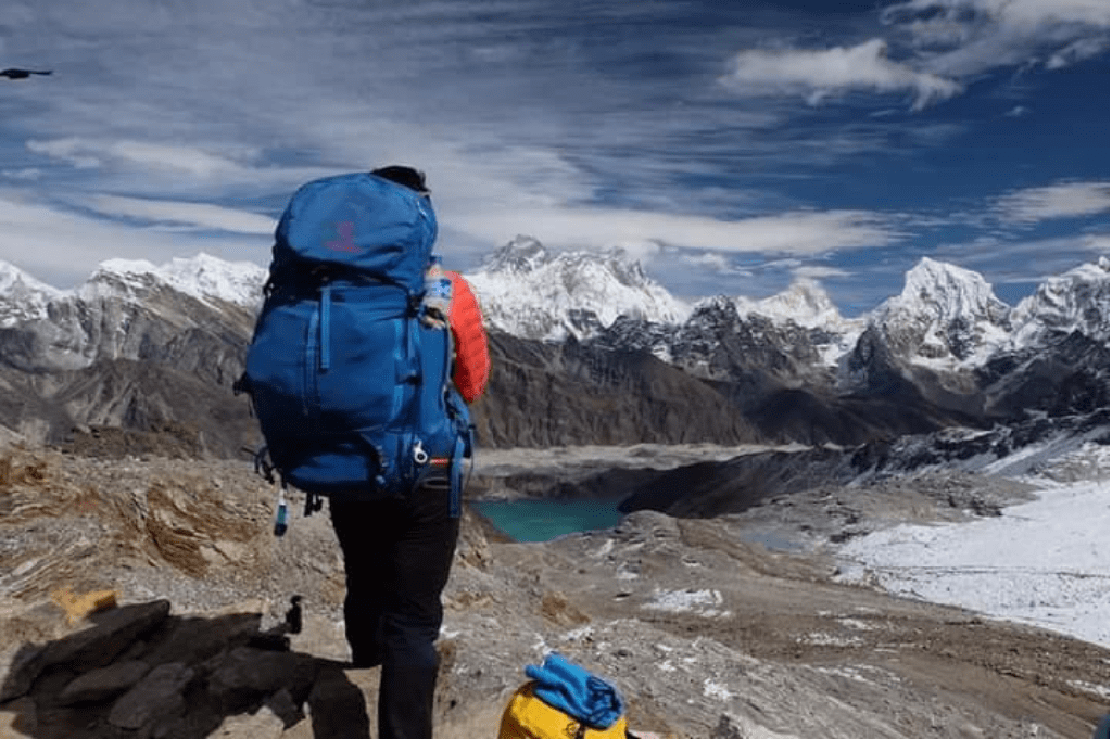
Everest 3 High Passes Trek
- 17 Days
- Nepal


